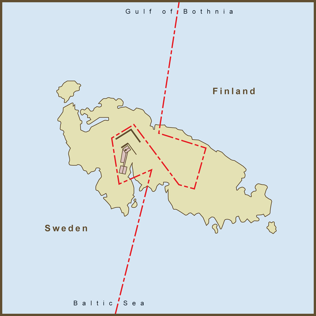
I love that story. We had a similar problem here but they didn't bother moving the border, it makes for some funny administration rules.This is a map of a small island between Sweden and Finland called Märket.
Broken Hill is a South Australian town but it exists in New South Wales. They are administered by South Australia and they are on South Australian time but they are subject to New South Wales road laws.
https://www.google.com.au/maps/plac...1.9595859!4d141.4608138!16zL20vMDEzYmJm?hl=en

")