-
Welcome to Autism Forums, a friendly forum to discuss Aspergers Syndrome, Autism, High Functioning Autism and related conditions.
Your voice is missing! You will need to register to get access to the following site features:- Reply to discussions and create your own threads.
- Our modern chat room. No add-ons or extensions required, just login and start chatting!
- Private Member only forums for more serious discussions that you may wish to not have guests or search engines access to.
- Your very own blog. Write about anything you like on your own individual blog.
We hope to see you as a part of our community soon! Please also check us out @ https://www.twitter.com/aspiescentral
You are using an out of date browser. It may not display this or other websites correctly.
You should upgrade or use an alternative browser.
You should upgrade or use an alternative browser.
Roads and Maps
- Thread starter Ackman12
- Start date
metalminx24
Well-Known Member
I love following maps [emoji4] I tend to learn where I'm going by places/buildings rather than street names though.
I love maps. I have very detailed world and US maps on my office wall. I am always on Google or Yahoo maps, just looking around. I also love to explore and I have a lot of topographical maps in my truck. When ever I am going into the back country, I make sure that I have a topo map of the area. My maps all have added details that I have written in. Back in my dirt bike days I always had a map or two in my tool bag.
23andaspie
aspie ordinary
Are you kidding me? I thought it was imperative that one documents all their trips and map logs using preferably a GPS receiver (I use a Garmin GPSMap 78sc, pretty much crap but it works for me). See below for an example track trace I uploaded into QMapShack, a free open-source program for Windows, Macintosh, and Linux which you should probably download if you haven't yet already.


I also custom waypoints (GPS coordinates) of places I deem important, as well as any necessary detail about that location. I cannot go on a trip with this thorough documentation, and I usually publish the trip results afterwards on GPSies.com.
I also custom waypoints (GPS coordinates) of places I deem important, as well as any necessary detail about that location.
Are you kidding me? I thought it was imperative that one documents all their trips and map logs using preferably a GPS receiver (I use a Garmin GPSMap 78sc, pretty much crap but it works for me). See below for an example track trace I uploaded into QMapShack, a free open-source program for Windows, Macintosh, and Linux which you should probably download if you haven't yet already.
View attachment 20478 View attachment 20479
I also custom waypoints (GPS coordinates) of places I deem important, as well as any necessary detail about that location.I cannot go on a trip with this thorough documentation, and I usually publish the trip results afterwards on GPSies.com.
That is cool. You would probably like geocatching or maybe you already do.
23andaspie
aspie ordinary
That is cool. You would probably like geocatching or maybe you already do.
I'm mostly into discovering undiscovered tall trees and cataloguing that information (see my page on monumentaltrees.com -- submissions on that site typically require accurate height measurements using a laser rangefinder as well as precise coordinates using a GPS).
Along such a trip I usually carry along my Garmin GPS, a DSLR, and a Nikon laser rangefinder.
In April I found a Douglas-fir that measured at approximately 207 feet tall and gave it the name Minnehaha Giant after the nearby creek.
Any others out here into the GPS business? For those without a dedicated unit, there seem to be a lot of good phone apps out there that do just as good of a job.
23andaspie
aspie ordinary
AGXStarseed
Well-Known Member
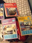
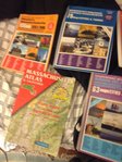
When I was younger I liked reading the Road Atlas - seeing where I'd been, where I'd like to go, following the railway lines, etc.
One of the things I remember most frequently was staring at the road signs section near the beginning - I don't know why but the signs always seemed to fascinate me.
Nowadays, I do like looking at Google Maps and checking out the locations of people I know to 'explore' the area from the comfort of my bedroom. Now that Google Maps has a 3D option, I do enjoy checking out places using it - even though sometimes it can take ages to load up.
Yes, definitely! When I was very young one of my brothers used to call me 'map mad', and when I was nine I could draw a perfectly proportioned map of the world using just a pen and a sheet of blank paper, without having to copy or trace from an atlas (the continent of Africa was especially easy). I knew where all the nations were as well, their capital cities... simple!
On the Inside
Well-Known Member
I am map mad, myself. I like to study maps of places I will be visiting and get a very clear picture of where I am going. I am often able to give people directions, even when I've only been in the area for a few hours.
One thing I like to do is test my sense of direction and landmark sighting abilities by going somewhere I am unfamiliar with and finding my way around by landmarks, unusual trees, rock outcroppings, sun location, etc.
There was only one time when I was getting a bit panicked that I might have been lost. But it was wicked windy, and trees where falling here and there around me, adding to the thrill. Turned out fine though.
I have a degree in cartography that helped me get one of my current jobs that has to do with roads. There I use my old street atlases to increase the height of my filing cabinet to block the view of people walking down the hallway. I'll probably recycle them one of these days. Haven't even opened them since everything is on the computer now. I actually just donated several like new early 1900's mapping and geography books to a garage sale. Had them for years and finally decided they were just taking up space.
I have ESRI available for mapping, but I've never found a need for it yet.
All of my GPS data (Leica Viva RTK) is imported into CADD and worked with there, but I mostly draw a lot of low tech quick reference maps for people by using scanned in .pdf maps as a background, and using the comment features in Adobe Acrobat Pro to add the data I need, and make links.
I use maps when traveling a new area,but have very complete visual waypoint logs of everywhere I have ever traveled as a result of the way autism wired my brain to use images as a way of maintaining memories. If I have already been somewhere and need to go there again,thousands of images are displayed of the entire route at the instant the trip was planned and get refreshed as the travel begins. My spatial abilities allow me to use routes to similar destinations until the details of a map are needed as I near the intended destination. My trip last week to Delaware was just a huge replay of images from my time spent there,the last one being 22 years ago. New construction in an area always throws me off on my internal GPS,but I have full sets of images of what it looked like the last time I saw it and can usually tell you what used to be there 
Thirty five years ago I delivered pizza in a small town of 24,000 people...I memorized the entire map of the town the first week I worked there. I knew how to beat every traffic light in town and can cross it during heavy traffic by using a system of alley ways and shortcuts I learned delivering pies there 
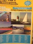
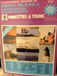
I like maps or atlases. I just like to look at them. I feel ok to say so here, but to most people I won't admit to liking maps enough to spend hours (if I had nothing important to do) just looking at them. I think it's the detail I like, and seeing what all the places are called. I don't tend to use them for getting to places though. If I haven't even got a clue of where somewhere is and I have to get there, I will look on a map to see where it is, but I won't use the map to get there. Instead, I will look on the map to see where my destination is in relation to a landmark I will see when I'm going there.
Old maps are also really interesting, because I like to see how things have changed, both with man made changes, and with older maps, the geological changes and also how the map-makers [cartographers?] perceived the world/country/town....
Old maps are also really interesting, because I like to see how things have changed, both with man made changes, and with older maps, the geological changes and also how the map-makers [cartographers?] perceived the world/country/town....
My dad was a surveyor and he used to take me on trips with him when surveying roads and/or dirt tracks all over New South Wales, Australia.
I got to see how maps are made from surveys and then plotted to the maps sold to the public.
I've always loved maps and creating my own.
Too much fun ...
I got to see how maps are made from surveys and then plotted to the maps sold to the public.
I've always loved maps and creating my own.
Too much fun ...
Whe
When you draw a map to show someone how to get somewhere, do you always put north on the top of the sheet of paper? I always do and I am surprised how many people do not or do not understand. In my minds eye, the top of the map is always north. Is it the same way in the southern hemisphere?My dad was a surveyor and he used to take me on trips with him when surveying roads and/or dirt tracks all over New South Wales, Australia.
I got to see how maps are made from surveys and then plotted to the maps sold to the public.
I've always loved maps and creating my own.
Too much fun ...
Absolutely! Always. It's amazing how many people ask what's that for the N with an arrow through it. I learnt that from my dad as well.
Have you a map person/vocation in your family too clg114?
No, but I wish there was because I am very interested geography and maps. You are very lucky to have had your father to show you.
New Threads
-
-
-
-
-
-
-
Missing the wonder and discovery of the old Star Wars movies.
- Started by Wolfnox
- Replies: 3
-
-
-

